
Burien Neighbors by Public Source
Each public source describes a different part of a Burien block. King County Parcel Viewer supplies the spatial frame. The assessor adds parcel facts and taxpayer fields. Landmark documents recorded interests in land. City permit files add dated projects, while directories and museum files preserve an older street scene. None is a complete current occupant list.
| Source | What It Shows About a Block | Access |
|---|---|---|
| King County Parcel Viewer | Adjacent parcels, addresses, PINs, zoning, districts | Free map with select, buffer, and export |
| Assessor property report | Parcel use, value, buildings, taxpayer, mailing and situs fields | Free web report |
| Landmark | Recorded transfers and encumbrances by parcel or legal description | Free index; copy and historic limits |
| Voter public list | Allowed fields by permitted geographic selection | Request and signed use declaration |
| Permit map or request | Recent address activity or older permit and code files | Recent map; city request for older files |
| Library and museum | Past occupants, block photos, clippings and local stories | Physical collections and finding aids |
An owner may live elsewhere, and a mailing address may belong to an agent. A voter entry confirms a registration match, not title or every household member. For Burien neighbors, record the exact field and date instead of converting every named role into “resident.” This small habit prevents most false conclusions.
Select Burien Neighbor Parcels
Open the King County Parcel Viewer and find the anchor lot by address or parcel identification number, called a PIN. Pan across nearby lots and click each parcel. Address points and parcel labels help separate a private lot from a street right-of-way. A zoning layer adds context but does not prove occupancy.
The Select parcels menu can draw a line, freehand line, polygon, or freehand polygon around a block face. Buffer Selected parcel(s) accepts a distance in feet and creates a radius around the anchor parcel. Multi-selected parcels can be exported. Clear the prior result before mapping a different block.
The cross-street tool asks for an “On street” and cross street. It can rescue a search when the street number is wrong or an old street name has changed. Map geometry remains approximate. A recorded plat, survey, and qualified surveyor control a legal boundary question.
The live viewer shown below is the right visual starting point for nearby lots.
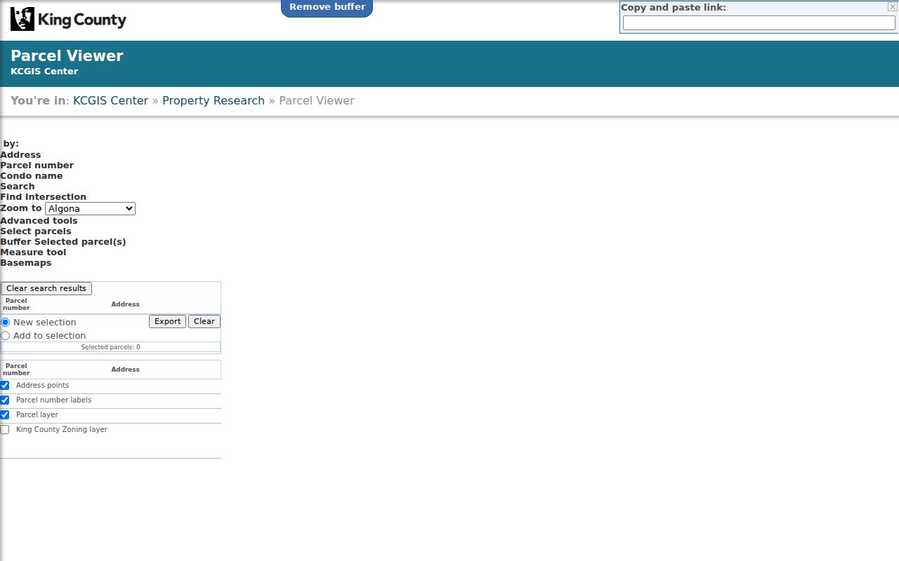
Its parcel selection tools turn one address into a focused block list without treating the entire street as one search.
Compare Burien Property Roles
After the map supplies each PIN, open the corresponding King County eReal Property report. Compare the situs address, which is the parcel’s physical address, with the taxpayer and mailing fields. Add parcel use, units, buildings, value, and sale history only when those fields answer the block question.
A taxpayer name is not a list of occupants. Likewise, the assessor interface inspected did not expose a verified public owner-name search, so use the PIN or address from Parcel Viewer. If a title question remains, search Landmark by parcel or legal description. The full named-street method belongs in the Burien street directory.
- PIN
- The parcel identification number used to connect the map, assessor report, tax record, and some recorded documents.
- Situs address
- The physical address assigned to the parcel, which may differ from the taxpayer’s mailing address.
- Recorded interest
- A documented legal interest in land. It does not by itself establish current residence.
Note: Compare the date on every property source because assessment, tax, sale, and recorded-document systems update on different schedules.
Map a Burien Neighbor Block
A short process keeps the search limited to the immediate block. Start with one valid address, build a parcel set, and verify the public role attached to each lot. Expand only when the purpose calls for it.
- Locate the anchor address or PIN in King County Parcel Viewer.
- Click adjacent lots or draw a polygon around the desired block face.
- Export or note each PIN, then open its assessor property report.
- Preserve owner, taxpayer, applicant, and occupant as separate labels.
- Use Landmark only when a recorded ownership question needs confirmation.
The result is a parcel-centered view of Burien neighbors, not a private household roster. Stop at the block edge. A whole street search has different scope, more records, and a separate workflow.
Burien Voter Data Nearby
My Voter Information cannot browse a block. It needs any three of first name, last name, date of birth, and house number, so it works only after a known-person lead. Washington public-list law allows certain geographic selections through a properly made request, signed penalty form, and lawful purpose.
Public fields can include name, address, political jurisdiction, gender, birth year, voting history, registration date, and registration number. Full birth dates, registration-source information, driver-license or Social Security number details, and protected-voter addresses are withheld. Washington has no party registration, and participation history never shows ballot choices.
Ask King County Elections for a clearly defined Burien precinct or district selection, current or canceled status, date range, and delivery form. The exact voter-file request form and fee schedule were not verified in the research, so confirm those details with Elections before ordering.
Burien Neighborhood Contacts
Burien’s official materials describe about 18 neighborhood areas. Names such as Seahurst, Maplewild, Three Tree Point, Gregory Heights, Downtown, Sunnydale, Five Corners, Chelsea Park, Beverly Park, Salmon Creek, and Southern Heights are useful place clues. They are community labels, not exact parcel boundaries.
City neighborhood pages
Burien neighborhoods
Area history and public civic context. No private member roster.
Community planning hub
Burien community hub
Planning documents, projects, and public participation links.
Discover Burien
Downtown community organization
Public events and organization information, not household membership.
No complete public HOA, block-watch, congregation, or civic-club roster was found. Use an organization’s public contact or meeting notice. Do not request a private membership list merely to identify neighbors.
Gregory Heights Name Clues
Local history gives Gregory Heights two older labels: Wobbly Hill and Poverty Hill. The names are tied to the World War I shipbuilding era and the Industrial Workers of the World “Wobblies.” They are search terms for old newspapers, photos, and directories, not labels for present residents.
This is a useful reminder for block research across Burien. A modern neighborhood or mailing label may not match the term used in an older clipping. Search the historic name alongside Burien, Highline, or the street name, then confirm any person through a dated primary record.
Other Burien place names deserve the same care. City and local-history sources use North Burien, Old Burien, Seola Beach, Woodside Park, Manhattan, Highline, and Sunnydale in addition to current neighborhood names. A newspaper item may describe a block by a school, shore, or local area instead of its present postal city. Keep the wording used by the source in the research notes, even when a modern map places the parcel inside Burien.
Annexation adds another layer. Manhattan and Woodside Park joined Burien in 1998, while the North Highline and Boulevard Park annexation took effect in 2010. Older county, directory, election, and community records can therefore carry a different locality label for the same ground. The parcel number and legal description provide firmer continuity than a city label alone.
Burien Neighbors Before Today
Historical block work starts at the library or museum when no current portal can answer it. A directory with an address index may list households or telephone subscribers in street order. Such entries are snapshots and can omit unlisted households. Exact official Burien reverse-directory coverage was not verified.
The Burien Library offers microform equipment and a Northwest Collection. Highline Heritage Museum finding aids cover photographs, oral histories, school material, obituaries, and Highline Times files. Those sources can show how a block was described and who appeared in public community records, but title claims still require assessor, deed, or court evidence.
The Washington State Library supplies a dated directory bridge: Burien volumes for 1962 to 1963, 1967 to 1968, and 1970 to 1975, followed by Seattle Suburban South runs for 1976 to 1983, 1985, 1987, and 1991. Check adjacent years rather than assuming one entry proves continuous presence. Pair a directory name with a deed date, property card, census entry, obituary, or photograph caption before placing that person on the block’s timeline.
Official Burien Neighbor Evidence
Commercial neighbor tools merge public and purchased data. That can be convenient, but stale addresses and same-name merges make them weak proof. Official records are narrower. They disclose a specific public role, date, and custodian, which makes errors easier to trace and correct.
| Source type | Strength | Main limit |
|---|---|---|
| Official parcel or deed record | Dated parcel, taxpayer, or recorded-interest evidence | Does not list every occupant |
| Official voter or permit record | Defined public fields and custodian | Use, privacy, and date limits apply |
| Commercial compilation | May combine many sources quickly | Can mix people and retain old addresses |
Verify any important block fact with the office that created it. If a field is wrong, report the parcel, document, or case number to that custodian rather than repeating the error.
Protect Your Burien Neighbors
A parcel map cannot reveal all renters, children, household members, utility customers, or postal recipients. Never infer a family tie from a shared mailing address. Court indexes suppress key identifiers, voter files withhold protected fields, and motor-vehicle addresses remain restricted.
The Washington Address Confidentiality Program supplies a substitute address and mail forwarding for qualifying protected participants. Their actual address, city, county, precinct, and related voter details are confidential. Do not try to infer a protected location from nearby public records.
Lawful use. Burien neighbor records support civic curiosity, local history, and safe contact. Never use them to watch, harass, intimidate, or harm anyone.
Keep notes limited to the question being answered. Share a source link or record date instead of copying sensitive details. Respect a person who does not want contact, and use public organization channels when the goal is a block meeting or local project.