
Walk a Burien Street From Address to Evidence
The Burien street directory works best as a chain of dated facts. A county parcel result can identify the physical parcel and taxpayer, while a deed identifies parties to a recorded transfer. Neither proves who lived at the address. Directory entries, permits, newspapers, and a properly obtained voter record may add residence clues, but each still needs its own date and role label.
- Enter the situs address in King County Parcel Viewer and confirm its map point, parcel number, jurisdiction, and legal context.
- Open the linked property report and record the taxpayer, mailing address, present use, units, buildings, and sale clues.
- Use Landmark with the parcel, legal description, and party names to identify recorded transfers rather than presumed occupants.
- Check Burien permit material and, for a known person, the limited voter confirmation route. Do not infer a household from either.
- For older occupants, search the exact year and original locality label in directory, newspaper, and archive collections.
Save the source date with every finding. Burien records may show one name as taxpayer, grantee, permit applicant, or listed resident. Those roles are not interchangeable, and a sound street-by-street worksheet keeps them in separate columns.
Map the Burien Street Directory With Parcel Tools
King County Parcel Viewer is the main spatial tool for a Burien by-address search. It accepts an address, parcel number, or condominium name. Its intersection search and map controls can place an address in the right street segment before any person name is used.
| Map control | Input or action | Street research use |
|---|---|---|
| Address | Situs address text | Locate the physical parcel |
| Parcel number | PIN text | Return to a known legal parcel |
| Condo name | Name text | Find a condominium parcel set |
| Select parcels | Line or polygon | Collect a street face or segment |
| Buffer parcels | Distance in feet | Expand around a chosen set |
| Export | Selected features | Preserve parcel identifiers |
Parcel summaries can show present use, jurisdiction, taxpayer name, address, value, lot area, levy code, units, and buildings. Property Report and Districts Report links add context. Boundary lines remain approximate and are not a legal survey.
For a whole street face, select parcels with a line or polygon instead of repeating single-address searches. A buffer can widen the review by a stated number of feet, and export preserves the selected parcel set. Clear the selection before beginning another segment so unrelated parcels do not carry into the next result. The address-point, parcel-number, parcel, zoning, and district layers can then be compared without treating their boundaries as surveyed lines.
The captured Parcel Viewer screen shows the official workspace used in this Burien street directory.
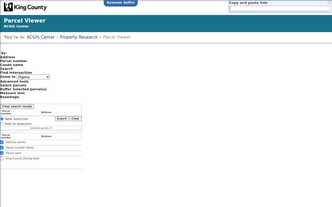
The map is the geographic starting point; its taxpayer field must still be checked against the assessor report and recorded instruments.
Official Burien Street Directory Record Layers
No office keeps a single Burien street directory of every occupant. The useful address layers sit with county GIS, the Assessor, Recorder, Treasury, and Burien Permit Center. Their fields overlap enough to confirm a parcel while preserving what each record actually proves.
| Record Set | Keeper | What It Shows | Access |
|---|---|---|---|
| Property report | King County Assessor | Taxpayer, mailing and situs addresses, value, use, sale clues | eReal, eMap, phone, or counter |
| GIS parcel map | King County GIS | PINs, adjacent parcels, zoning and districts | Free viewer, selection, and export |
| Recorded instruments | King County Recorder | Parties, dates, document type, legal description | Landmark, counter, mail, or Archives |
| Voter record | King County Elections | Limited registration fields under state rules | Known-person match or qualified request |
| Permit file | Burien Permit Center | Address-linked work, applicant or owner field, and date | Recent map, portal, or city request |
The parcel number is the cleanest bridge among these systems. The legal description becomes more important as the chain gets older, since parcel numbers were not used consistently until about 2002. A street name is useful search text, but it is not a stable legal key.
Separate Burien Situs and Tax Mailing Addresses
The King County Assessor eReal Property report distinguishes the situs, meaning the physical parcel, from the address used for tax mail. A mismatch can reflect an estate, business contact, prior address, mailing service, or an owner who receives mail elsewhere. It is a clue, not proof that anyone resides at either place.
- Parcel or PIN
- The county identifier joining map, assessment, tax, and some recorded-document searches.
- Situs address
- The physical parcel location, which can differ from the taxpayer's mailing address.
- Plat
- A recorded map dividing land into lots, blocks, tracts, streets, or easements.
- Criss-cross directory
- A directory arranged by address or street, useful for a dated occupant clue when that index exists.
The captured eReal Property screen illustrates the county's parcel-oriented approach for a Burien street directory search.
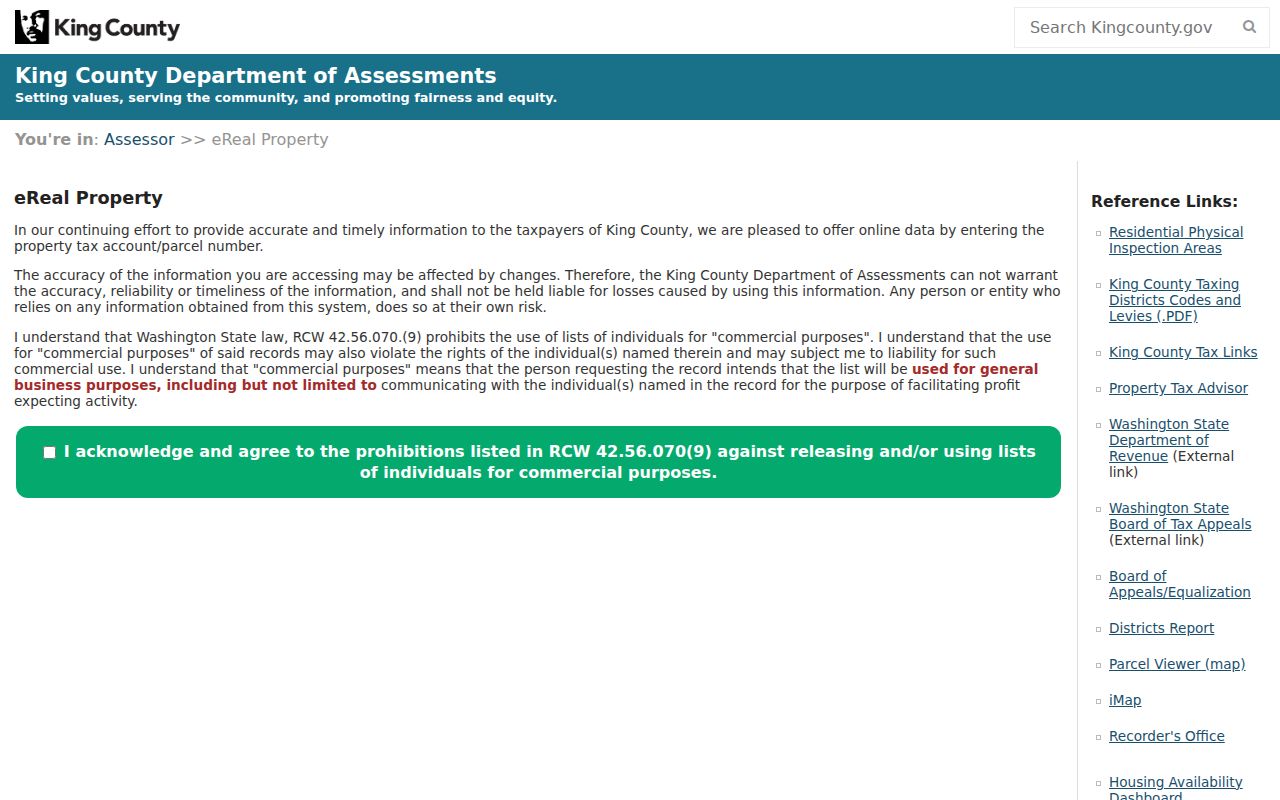
Because an owner-name form was not confirmed on that screen, start by address or parcel and use Recorder records when the task turns to names.
Build a Burien Street Directory Deed Trail
King County Landmark Web indexes recorded documents from 1976 forward. Parcel search reaches 1997 forward, while most document images begin August 1, 1991. Search the current owner as grantee near the acquisition date, open the deed, record both parties and the legal description, then search the grantor's earlier acquisition.
A detail may include party name, document type, recording date, instrument number, book and page, parcel prefix, consideration, legal description, and an image link. Results load a page at a time, so sort and filters must be applied again on each page. Name, instrument, book/page, parcel, date, and legal modes solve different index problems.
Name Search expects the last-name, comma, first-name pattern. Document Search narrows by instrument type and date, while Advanced Legal Search can follow a lot, block, plat, or tract when a modern address fails. The first ten parcel digits are used with the Starts With option in parcel mode. A complete street chain may require more than one mode because an easement, lien, plat, survey, mortgage, or deed can index different parties against the same land.
The recorded-document search capture shows the official portal behind the deed layer of the Burien street directory.
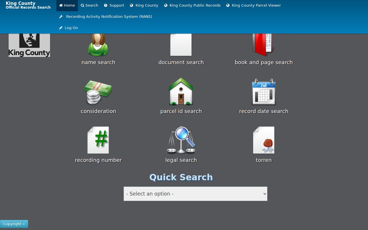
Online images are not certified. Copies can be ordered through the cart, at the Seattle counter, or by mail using the Recorder's copy request form.
Note: The broad index starts in 1976, but parcel mode starts in 1997 and does not replace a legal-description search.
Date the Burien Street Directory With Permits
The Burien Permit Center publishes an interactive map of permitted activity during the past 18 months. City instructions for MyBuildingPermit confirm Address, Parcel Number, and Owner Name search routes. A result may establish when work was proposed or inspected, though it is not a household roll.
For older or closed material, use the Burien public-record route. Give the full address, parcel number, permit or case number if known, record type, and date range. City Hall and Permit Center phone service provide alternatives when the map or external portal does not expose the needed file.
Why a Burien Street Directory Is Not a Voter Roll
King County My Voter Information confirms a known person with any three of first name, last name, date of birth, and house or building number. It is not an open browse-by-street tool. Registration updates daily, but a match does not prove title, continuous occupancy, or every member of a household.
Public lists are governed by RCW 29A.08.720 and WAC 434-324. A qualified request can specify Burien precinct or district geography, current or canceled status, allowed fields, and format. Full birth dates, identity numbers, protected addresses, and ballot choices are not ordinary public fields. Washington does not register voters by party.
Note: Street-wide voter access requires a formal request and use declaration; the free confirmation page cannot produce an address roster.
Search the Burien Street Directory Under Earlier Names
Address continuity is a central Burien street directory problem. Former Crosby Road is now SW 146th Street. City history follows one site from farm and residential land to Chelsea Park Elementary, a community center, the Annex, and eventual demolition. A search using only today's street wording can miss much of that record trail.
Jurisdiction labels shifted too. Burien incorporated in 1993, added Manhattan and Woodside Park territory in 1998, and annexed North Highline and Boulevard Park in 2010. Older sources may say Highline, White Center, Seahurst, or unincorporated King County. Preserve historic, postal, city-limit, and current situs labels as separate facts.
For the volume years, use the Burien city directory guide rather than assuming a modern address appears under a modern place name.
Continue a Burien Street Directory Beyond the Web
When Landmark reaches its cutoff, the King County Archives recorded-documents guide is the next stop. Its General Recordings Index covers 1853 through 1975 on microfilm by grantor and grantee. Property cards cover all parcels from 1937 through 1972, and legal-description abstracts can carry ownership changes through 1990.
The Recorder counter at 201 S Jackson Street in Seattle handles in-person viewing and copy needs. Mail requests can identify document numbers, dates, parties, plat, volume and page, or parcel details. For local newspapers, clipping files, maps, and microform equipment, Burien Library provides the practical Burien access point. Online absence does not establish that no record exists.
Recorder service is also available by phone at 206-477-6620 and by email at KCROCust@kingcounty.gov. Online users can register, place an instrument in the cart, and choose a certified or uncertified copy. An uncertified copy can print through the portal, while certified copies are mailed. A mail order should state the requested copy type and include requester contact details, quantity, and payment in an accepted noncash form.
The Assessor offers another human fallback at 206-296-7300 or the King Street Center counter. That route is useful when a parcel report needs explanation, but an assessor answer still should not be converted into an occupant claim. For a city-held address file, Burien City Hall and the Permit Center have separate custody, so the request must go to the agency that created or keeps the record.
Record the response date, office, requested range, and any stated limitation beside each Burien address finding.
What a Burien Street Directory Leaves Unknown
A parcel map cannot list every person at an address. Owner records omit many occupants, and a tax mailing destination is not a residence finding. Utility customers, children, postal recipients, protected residents, and many household members do not form a public Burien street directory. Motor-vehicle address data is restricted, while sealed court details and confidential voter addresses remain outside ordinary access.
Use the narrowest record needed for family history, property research, civic review, or safe contact. Washington's Address Confidentiality Program supplies protected participants a substitute address and confidential handling, so a public-facing address may intentionally not identify a person's actual location.
Lawful use. Burien address records support legitimate personal and historical research. Never use an address trail to stalk, harass, intimidate, or harm anyone.