
Burien ZIP Directory Coverage
The Burien GIS address layer includes four ZIP values tied to Burien-area addresses. They are delivery geographies, not municipal borders. The layer also stores a city field and a separate limit code, allowing an address to be tested as within Burien, within 500 feet, or outside. The official regional maps show why a ZIP code directory needs a boundary warning.
| ZIP Code | Areas Covered | Post Office | Notes |
|---|---|---|---|
| 98146 | Burien, White Center, and nearby areas | Confirm by full address | Includes addresses outside incorporated Burien |
| 98148 | South Burien, SeaTac, and airport-adjacent map context | Exact route not verified | Appears in city GIS but is not a city-limit proxy |
| 98166 | Burien, Seahurst, Shorewood, and nearby west areas | Burien Post Office | Exact delivery boundary needs USPS verification |
| 98168 | Burien area, White Center, and airport-adjacent region | Exact route not verified | Postal and city labels diverge in places |
The King County ZIP map supplies regional polygon context. It should not be used as a resident count or a claim that all four ZIPs cover every Burien neighborhood. No official Burien ZIP-level population or registration counts, split history, PO-box-only ZIP, or unique institutional ZIP were verified.
Read each table row as a search prompt, not a fixed neighborhood roster. For 98146 and 98168, White Center and nearby unincorporated geography can matter as much as the word Burien. The 98148 area reaches toward SeaTac and airport-adjacent map context. The 98166 row has the strongest verified station detail, yet even that station does not define the postal polygon. When a result carries Des Moines or Normandy Park in the city field, compare the full address and limit code before assigning it to Burien.
Verify a Burien ZIP First
Use the USPS ZIP Code Lookup with the full street address before searching public records. A city name alone is too broad. Postal routing can retain a familiar mailing city even when the parcel lies in another jurisdiction, and a neighborhood label may have no postal force at all.
Copy the standardized address and ZIP returned by USPS. Then compare it with the Burien GIS city and limit fields. If the two systems differ, preserve both results. The postal answer is right for delivery; the municipal layer is the better starting point for city permits, code records, and a Burien Public Records Act request.
Keep the date of each check. The King County ZIP map and the January 2013 regional map in the research are useful snapshots, but source data and postal routes can change. A full address lookup is more precise than reading a boundary from a small-scale PDF. For a historical question, save the modern standardized form without replacing the spelling found in the older record. Both versions may be needed to connect a directory entry with a current parcel.
Burien Post Office in 98166
The only Burien station tied to a specific ZIP in the official source set is the Burien Post Office, 609 SW 150th Street, Burien, WA 98166-9998. Its listed phone is 206-248-8647. Posted hours were Monday through Friday, 8:30 a.m. to 5:30 p.m., and Saturday, 8:30 a.m. to 3 p.m.; confirm live hours before visiting.
A station address does not define the complete 98166 delivery polygon. It also does not establish which station serves every address in 98146, 98148, or 98168. Use the location page for counter details and the address lookup for the actual ZIP. That distinction keeps the Burien ZIP code directory factual even when postal routes change.
Find Burien Residents by ZIP
No inspected public portal offered a simple, complete roll of Burien residents by ZIP. The city GIS layer can return address features by ZIP attribute. King County Parcel Viewer searches an address, parcel number, or condominium name, while My Voter Information confirms a known person from matching identity fields. A sound ZIP code directory workflow narrows geography without treating it as a household list.
- Verify the full address and mailing ZIP through USPS.
- Query or inspect the Burien GIS address layer for ZIP, city, parcel, full address, and limit status.
- Open King County Parcel Viewer with a selected address or parcel number.
- Use My Voter Information only to confirm a known voter with three matching identity facts.
- Move to a street or parcel search after the ZIP has reduced the geographic field.
For a full street after the ZIP is narrowed, use the Burien street directory. That workflow owns the parcel, deed, and address chain. A ZIP-wide voter browse is not available through the personal voter portal, and no ZIP-wide result list was verified in the property-tax or permit systems.
Fields Behind Burien ZIP Searches
The Burien GIS layer is the one verified local source with ZIP as an address attribute. The other public tools use narrower keys. These differences matter when a broad postal search produces no result.
| Source | Accepted search or field | ZIP-wide mode | Useful result |
|---|---|---|---|
| Burien GIS address layer | ZIP, city, parcel, full address, limit code | Queryable layer | Address and city-limit relationship |
| King County Parcel Viewer | Address, parcel number, condo name | Not visible | Parcel, map, property and district reports |
| My Voter Information | Any three of first name, last name, birth date, house number | No | Known-person registration confirmation |
| Property-tax portal | Account or parcel | Not verified | Tax account and parcel information |
| MyBuildingPermit instructions | Address, parcel number, owner name | Not verified | Matching permit property selection |
When a portal lacks a ZIP filter, do not force one. Start with the GIS or USPS result, select an address, and carry its parcel number into the county system. The ten-digit parcel identifier is usually a stronger record key than a postal area.
The GIS result can expose the full address, city, ZIP, parcel number, and proximity to Burien's limit in one record. Parcel Viewer then adds map context, district information, and a property report. Its mapped lot lines are approximate, so they cannot settle a legal boundary dispute. The assessor and tax portals also distinguish a physical, or situs, address from a mailing address. A mailing address belongs to the tax-contact record and does not by itself show who occupies the site.
Annexation Changed Burien Geography
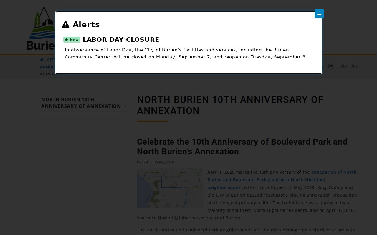
Burien incorporated in 1993, then added Manhattan and Woodside Park in 1998. The North Highline and Boulevard Park annexation became effective April 1, 2010. The city described that addition as about 15,000 residents, 36 street miles, and six parks.
Postal geography did not become a clean copy of the new city line. Older records may identify a current Burien block as White Center, North Highline, or another community. Search the name and ZIP used at the date of the record, then compare the current boundary. This history explains part of the large population change between the 2010 and 2020 census counts.
The city's annexation history documents the boundary change behind many postal and jurisdiction mismatches.
Note: State the date of the city boundary whenever a historical Burien population or address comparison spans the 2010 annexation.
Burien Addresses Have Five Identities
A modern location can have a physical address, a USPS mailing label, a King County parcel number, a legal description, and a municipal jurisdiction. Historical directories add a sixth clue: the publisher's place label. Around White Center, North Highline, Seahurst, Normandy Park, Des Moines, SeaTac, and airport-adjacent areas, those labels may disagree without any source being wrong.
Parcel numbers were not consistent in older King County records until about 2002. For a historical search, save the lot, block, plat, legal description, and name alongside the current address. The former Crosby Road, now SW 146th Street, is one local example of why a present street label can miss an earlier record trail.
Historical directories add another complication because older Burien runs predate current boundaries and may organize people by a postal or suburban label. The Washington State Library lists Burien volumes for 1962–63, 1967–68, and 1970–75, followed by Seattle Suburban South volumes through 1991 with gaps. Those books do not provide a modern ZIP filter. Search the surname and street as printed, then use a dated map or parcel description to relate the entry to present geography.
Address-based city records can help after that match. Burien's Permit Center publishes a map of recent permitted activity and routes searches by address, parcel number, or owner name through MyBuildingPermit. Older permits and code files may require a focused Public Records Act request with the address, parcel, date range, and record type. That is a jurisdiction-based request, so confirm the city-limit status before sending it to Burien.
Burien ZIP Codes Versus Limits
The city boundary and postal boundary serve different agencies. USPS assigns delivery geography. Burien GIS identifies jurisdiction and distance from the municipal line. County records use parcel and legal keys, while an old city directory may follow a publisher's market area. Check all four when an address near the edge of Burien produces mixed city names.
- ZIP and ZIP+4
- A ZIP covers a delivery area. The extra four digits can narrow mail to a smaller route, building, or group of boxes.
- PO-box ZIP
- A postal code assigned mainly to boxes at a post office rather than ordinary street delivery. None was verified as Burien-specific here.
- Unique ZIP
- A code assigned to one large organization or site. No Burien example was verified.
- Carrier route
- The group of stops served by one postal route. It is not the same as a neighborhood or city boundary.
For city permits and records requests, rely on the jurisdiction field. For mail, rely on USPS. For deeds and assessments, use the parcel number and legal description. This division of labor is more accurate than forcing each result into one Burien ZIP code label.